In the early 20th century it was common for mail to be sent without an address. A letter addressed to “Reginald Doe” with an address of “City” would have no trouble arriving to an addressee in the same town provided there was only one person with that name. In small-to-medium-sized towns in 1910, that was enough to ensure delivery.
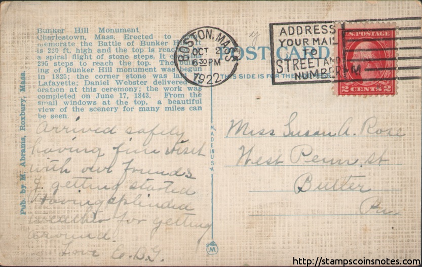
In the 1920’s some post offices encouraged senders to write street addresses on mail. An example can be found here on this postcard from 1922 with a postmark reading “Address your mail to street and number”:
In 1943, due to a shortage of experienced postal carriers caused by World War II, postal zones were created. They were intended to make sorting and delivery easier within the 178 most populous areas of the United States. A typical address would then read:
Reginald Doe
1123 Main St.
Long Beach 3, California
In 1963, the “Zone Improvement Plan” was created based on a 1944 proposal by the postal inspector Robert Moon. It is a system of five-digit codes used for routing mail to a more specific location. This plan made use of the existing postal zone codes, using three prefix digits in conjunction with the existing postal zone. The previous “Long Beach 3” postal zone became ZIP code 90803.
The first digit of a ZIP code generally indicates how far west a location is. States on the east coast have zip codes beginning in 0, while Pacific states have zip codes beginning with 9. The 0 prefix was also used for U.S. Territories such as Puerto Rico and the Virgin Islands.
At the same time, the post office started encouraging the use of two-letter state codes. The theory was that compressing the name of the state would make it easier to make room for the five-digit ZIP.
In 1967 the ZIP code was made mandatory for bulk mailers of 2nd and 3rd class material.
In 1983 the nine-digit ZIP+4 was created. This includes more specific location data with the first two digits being “sector”, such as a group of streets or high-rise building, and the second two being “segment”, such as a specific city block or floor of a skyscraper.
For post office boxes, each box has its own unique +4 code. In the case of box numbers with four or fewer digits, this is simply the box number.
The ZIP+4 scheme has not been widely adopted for non-commercial mail and is not required, but it is used extensively by postal processing and sorting equipment. Bulk mailers receive a discount on postage if they pre-print the postnet barcode for the extended ZIP code on their mail.
Though intended primarily for mail routing, the 42,000+ zip codes are used for statistical aggregation by the Census Bureau and are used extensively by business for marketing and customer data aggregation purposes. It is also very common to see real estate data aggregated by zip code.